


America 250: Footsteps Through History
Discover the rich history of the Chicago Southland, where crossroads, rail lines and hidden pathways tell stories that helped shape a nation. Drive the Lincoln Highway, the country’s first coast-to-coast road; ride the rails to the Pullman neighborhood, an iconic hub of industry and labor rights; and retrace the paths of freedom seekers traveling along the Underground Railroad, tracing the routes that once led to hope and liberty. Follow these footsteps through history, where each step tells a story of community, change and courage.
The Lincoln Highway: America’s First Road Trip
In 1913, America’s first coast-to-coast road was formally dedicated. The Lincoln Highway was designed as a transcontinental highway, stretching from Times Square in New York City to Lincoln Park in San Francisco, spanning more than 3,000 miles across the country. As the first of its kind, the Lincoln Highway brought economic growth to the countless cities, towns and villages along its route, earning it the nickname “The Main Street Across America.”
Throughout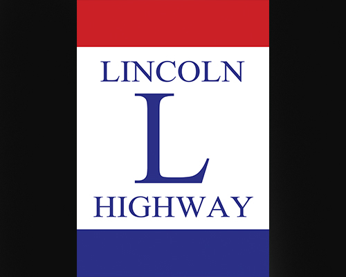 Illinois, the Lincoln Highway stretches 179 miles, about 25 of which run through the Chicago Southland. These 25 miles pass through multiple towns, beginning in the Village of Lynwood to the east and moving west to the Village of Mokena.
In the Village of Chicago Heights, travelers can visit the historic intersection of the Lincoln Highway and the historic Dixie Highway, a crossing that earned the community the nickname the “Crossroads of the Nation.” This landmark is also a highlight of the Triangle Tour, a scenic itinerary that connects three of America’s most iconic roadways: the Lincoln Highway, the Dixie Highway and the legendary Route 66. With 2026 marking the 100th anniversary of Route 66, there’s no better time to tackle the triangle. Plan your journey at VisitChicagoSouthland.com/TriangleTour!
At this notable intersection sits the Arche Fountain, built in 1916. The fountain was commissioned by the Arche Women’s Club, which was once one of the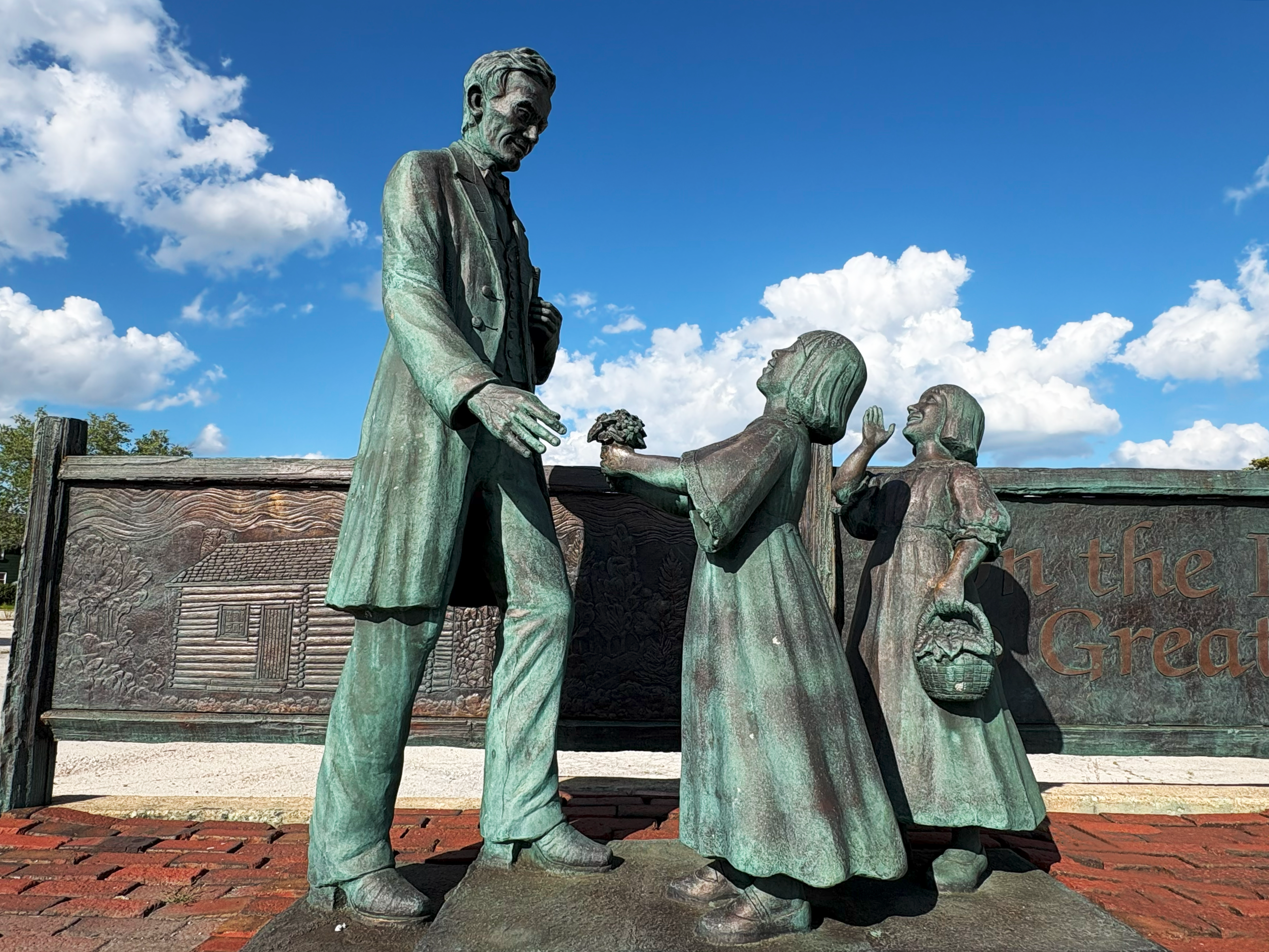 largest women’s clubs in the Chicagoland area. Also found at the crossroads is the “Lincoln on the Road to Greatness” statue, depicting President Abraham Lincoln receiving flowers from two young children. This statue is especially unique, as it is one of the few depictions of President Lincoln smiling.
Unique to the Chicago Southland area, this section of the highway features eight murals, completed in 2012, featuring local and national Lincoln Highway history, as well as three interpretive gazebos. Explore the murals using the information below.
Murals:
- Lynwood (21460 East Lincoln Highway) – This mural depicts the father of the Lincoln Highway, Carl G. Fisher, and the beginning of his 1912 promotion of his dream transcontinental highway to promote the rise of automobiles.
- Sauk Village (1 Sauk Trail Plaza) – Installed on the Dollar Tree building at the intersection of Torrence Avenue and Sauk Trail is a depiction of early 20th century life on the Lincoln Highway’s Kalvelage Bridge, where cars and livestock shared the road.
- Chicago Heights (137 East 14th Street) – Based on a vintage photograph of the McEldowney Bridge over Thorn Creek, this mural highlights advancements such as pedestrian walkways and concrete lanterns, and commemorates Henry C. Osterman, the Lincoln Highway Association’s first field secretary.
- Park Forest (348 Victory Drive) – Depicting the dedication of the coast-to-coast highway in honor of President Abraham Lincoln, this installment highlights its dedication to unite Americans from all walks of life.
- University Park (580 Farmview Road) – Located inside the Riegel Farm Complex, this mural depicts the first women to make a solo coast-to-coast trek (on motorcycles!) across the Lincoln Highway, sisters Adeline and Augusta Van Buren.
- Matteson (3627 West 216th Street) – As transportation grew along the Lincoln Highway, the Mahler family’s garage met the public’s automotive needs, and the mural—displayed on the original building—features photo corners and binding holes that make it resemble a family photo album page.
- Frankfort (11008 West Lincoln Highway) – In honor of four Eagle Scouts, this mural depicts the boys on their nationwide tour to promote the Lincoln Highway and perform safety demonstrations in July 1928.
- Mokena (11104 Front Street) – The final westernmost Chicago Southland Lincoln Highway mural shows the Cooper & Hostert Garage, Mokena’s first Ford dealership that operated for over 50 years.
Other area highlights along the Lincoln Highway include the 1950s Park Forest House Museum; Park Forest Historical Society (227 Monee Road, Park Forest), located inside of St. Mary’s Catholic Church (the museum is moving spring 2026, call prior to visiting); the soon-to-be-opened Matteson Caboose Park (Locust Street and 215th Street, Matteson) and The Trolley Barn (11 White Street, Frankfort), a barn-turned-mini-mall housing specialty shops. If you’re eagle-eyed, you may also spot a small stretch of paving from the original Lincoln Highway.
Today, over 100 years since its inception, the Lincoln Highway continues to connect communities throughout the Chicago Southland and beyond, living up to its legacy as the “Main Street Across America.”
The Pullman Connection: Railroads, Labor and Progress
The historic Pullman neighborhood is more than just rowhouses and railyards. It’s an entire community that tells the story of railroads, labor struggles and visions of progress that helped shape the nation.
In 1867, industrialist George M. Pullman founded his manufacturing company, the Pullman Palace Car Company, that built and distributed extravagant travel accommodations for overnight passengers.
Pullman’s r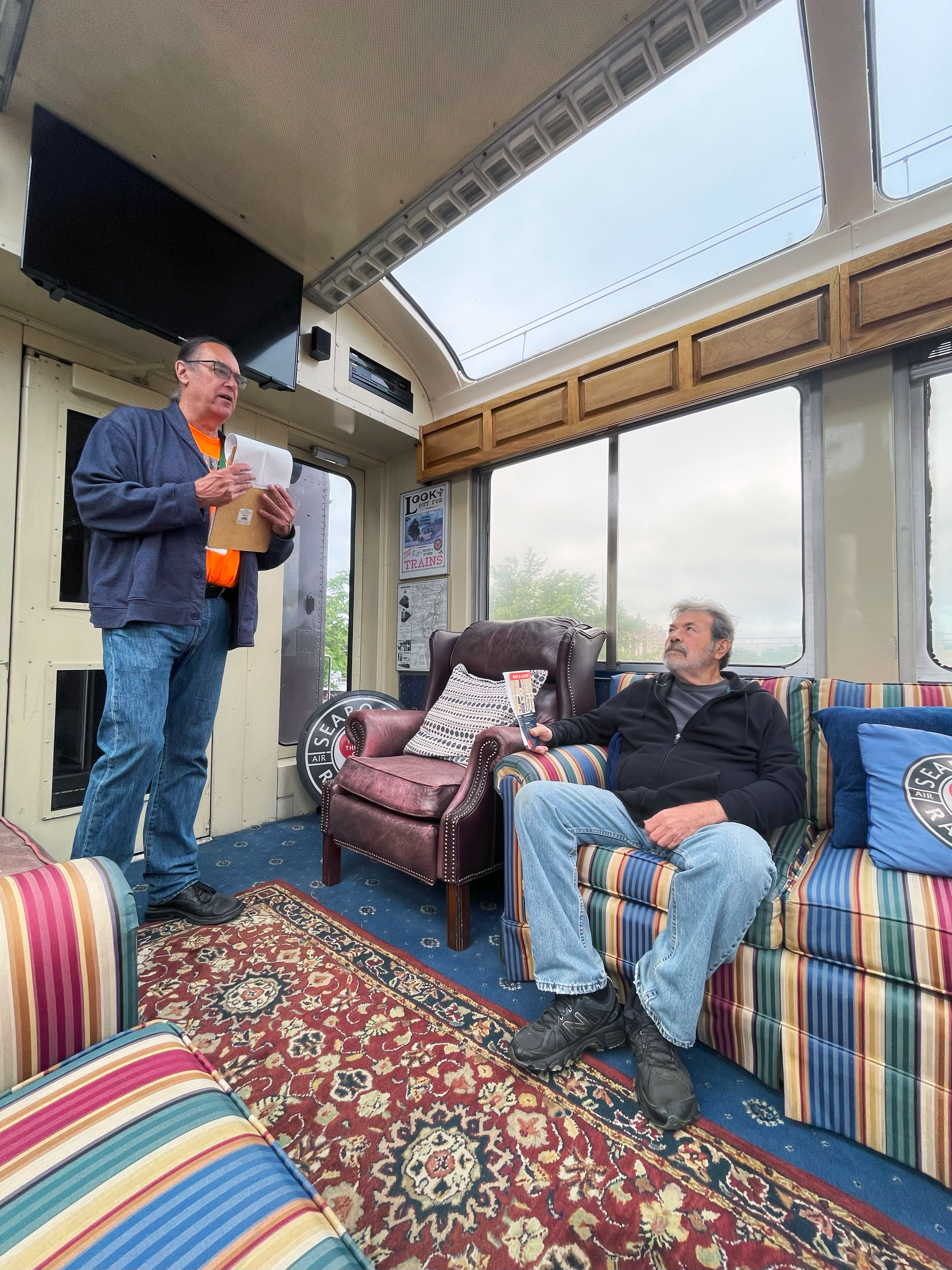 ailcars gained significant interest from the American public one year later, in 1865. Following his assassination, President Abraham Lincoln’s body was transported from Washington, D.C., to Springfield, Illinois, on a Pullman sleeper car, known as the Presidential. This railcar was commissioned by President Lincoln himself earlier in the year. After thousands of Americans lined the tracks to pay respects to their commander in chief, demand for the Pullman railcars skyrocketed.
In the 1880s, Pullman’s vision of a “model company town” came to life on the South Side of Chicago. This town within a town was created for employees of Pullman’s railcar factory and included housing, shops, churches and a hotel named for his daughter Florence, eventually totaling over 1,300 original structures. At the center of it all was the majestic red-brick Administration Building.
Although the neighborhood seemed idyllic, tensions came to a head in 1894 when demand for Pullman railcars declined. Jobs were cut, hours grew longer and wages were slashed. On May 11, 1894, employees of the Pullman Palace Car Company went on strike, igniting a pivotal moment in American history.
This protest, supported by the American Railway Union, soon heightened into a nationwide conflict that emphasized the growing struggle between labor and industry in the United States. Although this boycott was considered unsuccessful at the time, it demonstrated the power of organized labor and led to the creation of Labor Day. The Pullman Strike remains a poignant topic of discussion more than a century later.
Over time, demand for sleeping cars continued to decline, as rail travel faced increasing competition from automobiles and airplanes. The Pullman Palace Car Company’s factory shuttered in 1955, and the neighborhood officially transitioned into a historic district within the city of Chicago.
Six decades after the iconic company closed its doors for the last time, President Barack Obama officially designated the Pullman neighborhood as a National Monument on February 19, 2015, making the area the first National Park Service (NPS) unit in Chicago.
Today, the historic district includes the Administration Building, the grand Hotel Florence (537 East 111th Street, Chicago), the Greenstone United Methodist Church (11211 South St. Lawrence Avenue, Chicago), Arcade Park (11132 South St. Lawrence Avenue, Chicago) and dozens of preserved rowhouses. The National A. Philip Randolph Pullman Porter Museum (10406 South Maryland Avenue, Chicago), which recognizes and explores the immense impact of African American labor history, can also be found in the historic district. The museum is named after prominent civil rights activist A. Philip Randolph, a leader in the Black labor movement.
Visitors can explore the Pullman neighborhood through walking tours, virtual lunch and learn sessions, the HPF Speaker Series and, of course, the annual Pullman Railroad Days. For a more immersive experience, guests can step inside some of the community’s most iconic and well-preserved homes, gaining exclusive access while learning about their architecture, design and the history of the Pullman community. The Pullman National Historical Park NPS Visitor Center (11001 South Cottage Grove Avenue, Chicago) resides inside the historic Administration Building and houses historical exhibits, a gift shop and knowledgeable NPS rangers ready to answer questions and share insights.
Ongoing restoration efforts in the Pullman neighborhood continue to preserve this historic district for future generations. Once a “model company town,” Pullman now stands as a powerful reminder of the nation’s labor, industrial and cultural history as well as a testament to the resilience of the American spirit. By celebrating and maintaining Pullman’s heritage, we are reminded of the lasting impact of progress.
Freedom’s Path: Exploring the Underground Railroad
Before President Abraham Lincoln’s Emancipation Proclamation and throughout the Civil War, the state of Illinois played a key role in aiding freedom seekers traveling along the Underground Railroad. As a free state bordering Kentucky and Missouri, Illinois was one of the first stops for people fleeing enslavement and crossing the Ohio or Mississippi rivers. Safe houses and secret routes throughout the state concealed their travels.
The city of Chicago eventually became a hub for the Underground Railroad, and throughout the state, farmers, churchgoers, abolitionists and even politicians risked everything to support the fight for freedom. Today, travelers can visit these historic sites throughout the state, including several key landmarks in the Chicago Southland.
In eastern Will County and southern Cook County, settlers aided the efforts with safe houses along the old Sauk Trail corridor in and near the communities of Homer Glen, Park Forest and South Chicago Heights.
Soon to be housed in the historic Crete Congregational Church, the Crete Area Historical Society and Museum (550 West Exchange Street, Crete) is dedicated to preserving the structure’s legacy as a pivotal stop along the Underground Railroad. Originally built in 1853 as a house of worship, many of the church’s members were “conductors” committed to guiding freedom seekers to safety. On January 31, 1841, church members took an oath that still exists today in the church’s original minutes book, swearing to do everything in their power to bring about a peaceful and speedy end to slavery. Recognized for its significance, the church was dedicated as a historic site on the National Underground Railroad Network to Freedom Trail in 2018 by the National Park Service.
Near Riverdale and Dolton sits the former site of the Jan and Aagje Ton farm (557 East 134th Place, Chicago). The Tons, along with other Dutch settlers, were heavily involved in aiding fr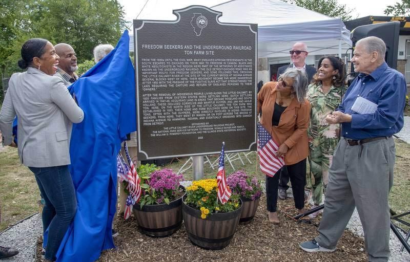 eedom seekers by offering a safe place to hide until secure passage to the next safe house could be arranged and providing food and supplies. This unassuming 40-acre farm plot along the Little Calumet River became a crucial stop for those seeking freedom in Detroit or Canada. Today, Chicago’s Finest Marina sits on the original site of the Ton farm. Purchased by Ronald Gaines in 2005, the property is the oldest Black-owned marina in Chicago.
Also found along the shores of the Little Calumet River is the African American Heritage Water Trail, established in 2020. The trail was established to help deepen connections to the river while highlighting the region’s rich history. Winding through several of Chicago’s South Side neighborhoods, the river carries 180 years of African American heritage. The trail spans from Beaubien Woods (West Doty Avenue South, southeast of East 130th Street and South Ellis Avenue, Chicago) to the village of Robbins and memorializes not only freedom seekers, but other trailblazers and pioneers like the Tuskegee Airmen and the Pullman Porters.
It is estimated that 2,000 to 3,000 freedom seekers came through the Chicago Southland. Today, visitors can retrace their steps along the Underground Railroad, offering travelers a meaningful way to experience and honor the past while exploring the significant sites that preserve vital pieces of American history.
For more locations with historical significance throughout the Chicago Southland, explore the newly launched Southland Heritage Trail by logging on to VisitChicagoSouthland.com/SouthlandHeritageTrail.


THINGS TO DO
EVENTS
DINING
ACCOMMODATIONS
PLAN YOUR TRIP
BLOG
MEETINGS
SPORTS
GROUP TOURS
SOCIAL EVENTS
MEDIA
MEMBERSHIP
ABOUT US
FACEBOOK
YOUTUBE
TWITTER
INSTAGRAM
LINKEDIN
TRIP ADVISOR
CONTACT US SITE MAP PRIVACY POLICY & DISCLAIMER ACCESSIBILITY STATEMENT
© Copyright 2001-2026 Visit Chicago Southland. All Rights Reserved. Developed by J Rudny, LLC
4801 Southwick Drive, Suite 225| Matteson, IL 60443-3102
(708) 895-8200 | Toll Free (888) 895-8233 | FAX (708) 895-8288